Property Record
1909 Unknown, Merritt Island, FL 32953
NEARBY LISTINGS FOR SALE OR LEASE
-
-
View all Merritt Island listings for sale on LoopNet.com
Property Detail
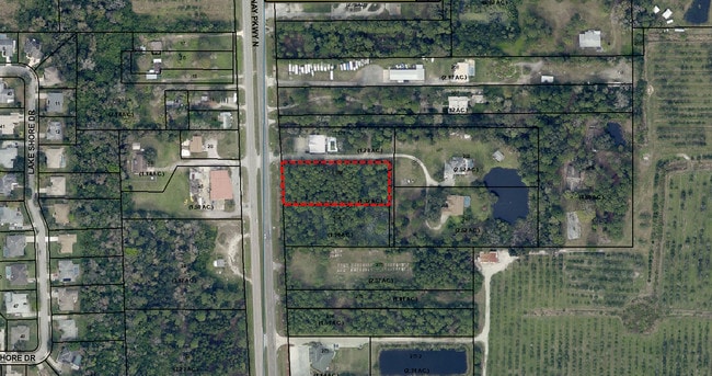
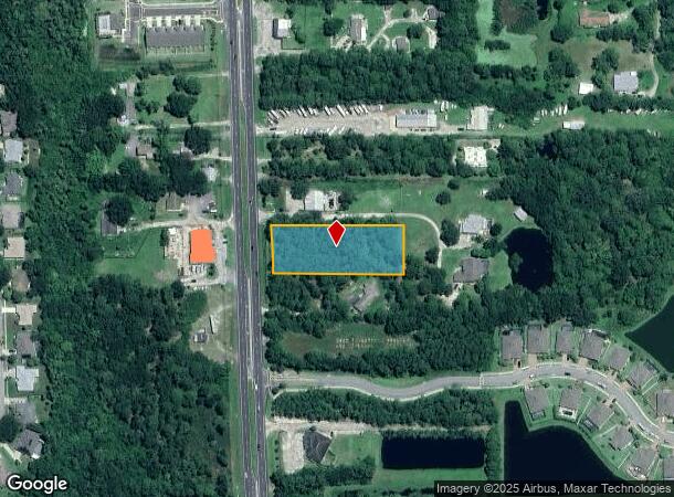
1909 Unknown
23-36-35-00-00266.0-0000.00
PART OF SW 1/4 OF NW 1/4 AS DESC IN ORB 673 PG 335 EXC ORB 1894 PG 20,1901 PG 305,1915 PG 309 2092 PG 710, 2201 PG 2476, 2285 PG 2277, 2822 PG 1839 & RD R/W
Commercialacreage
Brevard
X
Florida
12009C0329H
1.38 AC
2024
Brevard County
2025
Orlando
0699013209
Palm Bay-Melbourne-Titusville, FL
DEMOGRAPHICS near 1909 Unknown
1 Mile
3 Mile
5 Mile
2024 Total Population
2,904
10,273
36,112
2029 Population
3,175
11,202
39,336
Pop Growth 2024-2029
+ 9.33%
+ 9.04%
+ 8.93%
Average Age
50
47
46
2024 Total Households
1,210
4,222
15,264
HH Growth 2024-2029
+ 9.26%
+ 8.88%
+ 8.72%
Median Household Inc
$114,885
$105,555
$74,855
Avg Household Size
2.30
2.30
2.30
2024 Avg HH Vehicles
2.00
2.00
2.00
Median Home Value
$444,339
$418,799
$335,916
Median Year Built
1994
1994
1982
Nearby Places
Map Layers
Map Styles
 Street
 Aerial
- Restaurants
- Banks
- Shops
- Fitness
- Groceries
PUBLIC TRANSPORTATION
AIRPORT
Melbourne Orlando International
DRIVE
WALK
Distance
Melbourne Orlando International
51 min
35.7 mi
SALE & LEASE HISTORY
LISTING DATE
SALE/LEASE

Mar 28, 2017
For Sale
Nearby Properties
Address
Land Use
TOTAL SIZE
Lot Size
Zoning
Address
Land Use
TOTAL SIZE
Lot Size
Zoning
16,433 SF
89.08 AC
GML
Address
Land Use
TOTAL SIZE
Lot Size
Zoning
587.88 AC
Address
Land Use
TOTAL SIZE
Lot Size
Zoning
262,753 SF
24.35 AC
PIP
Address
Land Use
TOTAL SIZE
Lot Size
Zoning
212,534 SF
14.50 AC
Address
Land Use
TOTAL SIZE
Lot Size
Zoning
6,481 SF
22.73 AC
PIP
Address
Land Use
TOTAL SIZE
Lot Size
Zoning
109.06 AC
EU-2
Address
Land Use
TOTAL SIZE
Lot Size
Zoning
63,106 SF
271.68 AC
INL
Address
Land Use
TOTAL SIZE
Lot Size
Zoning
46,975 SF
10.90 AC
INL
Address
Land Use
TOTAL SIZE
Lot Size
Zoning
15,320 SF
113.85 AC
AU
Address
Land Use
TOTAL SIZE
Lot Size
Zoning
87,483 SF
4.20 AC
PIP(CUP)
Address
Land Use
TOTAL SIZE
Lot Size
Zoning
53,465 SF
1.96 AC
PUD
Address
Land Use
TOTAL SIZE
Lot Size
Zoning
58,962 SF
4.01 AC
BU1
Address
Land Use
TOTAL SIZE
Lot Size
Zoning
95.81 AC
GML-H
Address
Land Use
TOTAL SIZE
Lot Size
Zoning
Address
Land Use
TOTAL SIZE
Lot Size
Zoning
62,320 SF
4.82 AC
BU2
Address
Land Use
TOTAL SIZE
Lot Size
Zoning
24.27 AC
GML
Address
Land Use
TOTAL SIZE
Lot Size
Zoning
15.87 AC
BU-2
Address
Land Use
TOTAL SIZE
Lot Size
Zoning
23,332 SF
10.11 AC
IN(L)
Address
Land Use
TOTAL SIZE
Lot Size
Zoning
24,006 SF
150.08 AC
GML
Address
Land Use
TOTAL SIZE
Lot Size
Zoning
20,168 SF
8 AC
INL
Address
Land Use
TOTAL SIZE
Lot Size
Zoning
217.77 AC
AU
Address
Land Use
TOTAL SIZE
Lot Size
Zoning
21.59 AC
AU
Address
Land Use
TOTAL SIZE
Lot Size
Zoning
17,748 SF
21.12 AC
SR
Address
Land Use
TOTAL SIZE
Lot Size
Zoning
10,839 SF
5 AC
BU1A
Address
Land Use
TOTAL SIZE
Lot Size
Zoning
8,189 SF
3.58 AC
IN(L)
Address
Land Use
TOTAL SIZE
Lot Size
Zoning
29,117 SF
2.59 AC
PIP
Address
Land Use
TOTAL SIZE
Lot Size
Zoning
13,228 SF
11.99 AC
IN(L)
Address
Land Use
TOTAL SIZE
Lot Size
Zoning
8,743 SF
2.50 AC
IN(L)
Address
Land Use
TOTAL SIZE
Lot Size
Zoning
21,408 SF
1.45 AC
BU1
Address
Land Use
TOTAL SIZE
Lot Size
Zoning
27,700 SF
3.26 AC
IU
The World's #1 Commercial Real Estate Marketplace
Connect with us
© 2025 CoStar Group
The information above has been obtained from sources believed reliable. While we do not doubt its accuracy we have not verified it and make no guarantee, warranty or representation about it. It is your responsibility to independently confirm its accuracy and completeness. Any projections, opinions, assumptions, or estimates used are for example only and do not represent the current or future performance of the property. The value of this transaction to you depends on tax and other factors which should be evaluated by your tax, financial, and legal advisors. You and your advisors should conduct a careful, independent investigation of the property to determine to your satisfaction the suitability of the property for your needs.